Unmanned Vessel Guará Advances Hydrographic Mapping in Brazil
Apr, 17, 2024 Posted by Gabriel MalheirosWeek 202417
Under the moniker “Guará,” an Unmanned Service Vessel (USV) recently embarked on a journey to conduct hydrographic surveys (HS) to update the nautical charts of the Brazilian Navy. These charts, indispensable for safe navigation, encompass critical data such as water depth, underwater hazards, maritime signaling, and sea conditions. Regular updates are paramount to ensuring navigation safety, especially considering the dynamic nature of the seabed, port infrastructure, and navigational aids.
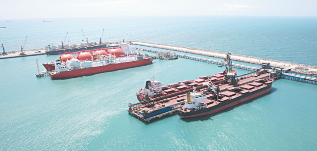
The initiative to conduct these hydrographic surveys was spearheaded by CIPP S/A, a joint venture between the State Government of Ceará and the Port of Rotterdam, which oversees the Pecém Industrial Port Complex. The project, named Guará, was devised to autonomously complete the necessary studies for the Navy, without the need for human crew.
In 2023, the complex achieved a notable throughput of 17.4 million tonnes, setting a record container throughput of 482,930 TEUs. Simultaneous multibeam bathymetry and shallow seismic studies were carried out in several important areas, totaling 18.29 km².
Prior to commencing the survey, three authorizations were obtained from the Navy Hydrography Center (CHM). WAMS Subsea Technology Solutions was entrusted by CIPP S/A with the execution of this project.
ABOUT THE USV OPERATION
The Guará is a Drix USV manufactured by the renowned French company iXBLUE. Equipped with state-of-the-art technology, including a Teledyne T50-ER multibeam echo sounder, GNSS receivers, and an iXBLUE Phins inertial sensor, among others, the vessel collected real-time data during the hydrographic survey.
Additionally, a Subbottom Profiler (SBP) was employed to map subsurface interfaces for studying seabed stratigraphy. Operating autonomously along pre-programmed lines, the Guará also conducted sound velocity profiling in the water layer, with data processing conducted using Qimera and Caris HIPS&SIPS software.
The results of the survey were meticulously evaluated by the Navy Hydrography Center. The comprehensive study, spanning 147.5 hours of surveying and covering 1,260.2 km of navigation, yielded invaluable insights.
Conducted under favorable weather conditions, with average winds of 8.6 m/s and sea states graded at 4 according to the Beaufort scale, the bathymetric survey adhered to the stringent guidelines of NORMAN 501 and publication S-44 of the International Hydrographic Organization (IHO). The results, classified as Special Order according to S-44 standards, were instrumental in updating nautical charts.
This pioneering endeavor marks the first utilization of a USV-type vessel for such a purpose in Brazil. Notably, the fuel consumption for the entire survey was a mere 502.5 liters, averaging an impressive 3.41 liters/hour. This significant reduction in CO2 emissions underscores the project’s commitment to environmental sustainability, aligning with global best practices.
Source: Revista O Empreiteiro
Click here to read the original news report: https://revistaoe.com.br/sondagem-autonoma-por-embarcacao-usv-no-porto-de-pecem-fornece-dados-a-marinha/
-
Ports and Terminals
Feb, 28, 2025
0
Brazil Signs Landmark Agreement to Secure Port Workers’ Pensions
-
Shipping
May, 29, 2024
0
ANTAQ Unveils Madeira River Concession Project to Investors
-
Ports and Terminals
May, 25, 2023
0
Port of Itajaí welcomes progress on municipal port authority transfer
-
Other Logistics
Jun, 13, 2024
0
Construction of state railway responsible for 62% of infrastructure jobs in Mato Grosso


