Brazilian gov’t outline new Port of Santos limits
Oct, 13, 2022 Posted by Gabriel MalheirosWeek 202231
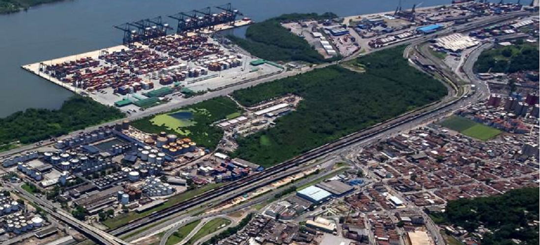
The Brazilian Ministry of Infrastructure (MInfra) issued a regulatory ordinance on October 11, outlining new limits to the Port of Santos. Nine months after the last review, the ministry decided to remove greenfield areas at Ilha de Bagres, and Largo do Canéu from the limits of the maritime complex.
The intention behind the ministry’s decision is to put an end to land and operation problems brought to light during the discussions of studies on the privatization of the SPA port authority.
Ordinance 1,366 of MInfra delineates the coordinates of the port, which encompasses the municipalities of Santos, Guarujá, Bertioga, Cubatão, and Biritiba Mirim.
According to the Ministry of Infrastructure, other changes were made, among them to the trajectory of the internal rail line and the area behind Santorini’s Private Use Terminal, as well as changes to the water area of Tiplam to allow for the expansion of its docking facilities.
There were also changes in the area that belongs to private facilities in the Alemoa region, the removal of the area known as Lagoa do Saboó as it is located inside a permanent environmental conservation area, in addition to the exclusion from the limits of the port of a site dedicated to federal judiciary power, the dry area belonging to the Navy’s Captaincy of Ports, as well as the Ilhas de Bagres and Canéu, as mentioned above.
“The organized port area comprises the port facilities and the infrastructure necessary for protecting and accessing the port, a public asset built and equipped to meet the needs of navigation, the movement of passengers or the handling and storage of goods, and whose traffic and operations are under the jurisdiction of the port authority,” stressed the ordinance.
According to the ministry, the changes above do not compromise the privatization project or the possibility of expanding port activities in the coming years. “The Ministry of Infrastructure intends to maintain these areas as future technical reserves for port activity, but also to integrate them with railway projects and other initiatives that maintain synergy with the needs of the port.”
The last change in the port’s polygon area was completed on January 19, 2022, with Ordinance 66 of the Ministry of Infrastructure, which was revoked. The text had expanded the operational area of the complex by almost two times, jumping from 8 to 15.5 square kilometers.
Most of the annexed lands were at the bottom of the navigation channel, in the Continental Area of Santos, encompassing Ilha dos Bagres and Largo do Canéu, which were seen as places for the expansion of port activity.
In August, the ministry opened a public consultation period that lasted ten days. At the time, the idea was to allow society to participate in the delimitation of the limits of the Port of Santos and possible adjustments before the Santos Port Authority (SPA) privatization. This state-owned company manages the port complex.
Source: A Tribuna
To read the full original article, please go to: https://www.atribuna.com.br/noticias/portomar/governo-federal-define-novos-limites-do-porto-de-santos
-
Shipping
Jan, 30, 2024
0
Ricardo Rocha takes on as Maersk’s new CEO for East Coast South America
-
Shipping
Mar, 07, 2023
0
Maersk removes Ningbo port call from Asia – Latin America service
-
Ports and Terminals
Aug, 28, 2024
0
Tunnel Project Between Itajaí and Navegantes and Study for Itajaí-Açu River Dredging Presented at “Santa Catarina Day”
-
Grains
Mar, 25, 2020
0
Reversal of ban allows Canarana (MT) to transport grain again

