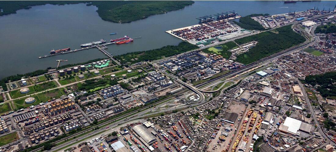
Brazil’s Port Minister Pledges to Double Port of Santos’ Size, Expanding into São Paulo’s Coastal Cities
Dec, 13, 2024 Posted by Denise VileraWeek 202448
The Port of Santos is poised to expand its size to 20.4 million square meters (m²) over the next 30 years, incorporating 12.6 million m² across Santos, São Vicente, Guarujá, and Cubatão. A decree to integrate 15 new areas and extend the port’s boundary by 162.4% is expected to be issued in February 2025.
The announcement was made on December 12 by Brazil’s Minister of Ports and Airports (Mpor), Silvio Costa Filho, and Anderson Pomini, President of the Santos Port Authority (APS), during a meeting at the Port of Santos’s administrative headquarters.
Mr. Pomini emphasized that the expansion is a critical milestone for the Santos port complex (currently area 7.8 million m²), with a primary focus on bolstering waterway transportation. He also noted the strategic importance of including areas in São Vicente to enhance this initiative.
Minister Costa Filho highlighted efforts to attract investment to the Port of Santos. “We plan to sign the decree in early February and, within six to eight months, advance strategic actions to attract investors for new development projects at the Port of Santos. President Pomini will lead a roadshow, meeting business leaders across Brazil to showcase this expanded strategic area,” he stated.
Pomini highlighted Vila dos Criadores’s inclusion among the new areas, calling it “the last prime area on the Right Bank of the Port of Santos.”
The chart below compares container exports and imports at the Port of Santos between January 2021 and October 2024. The data is derived from DataLiner, a Datamar-powered intelligence product.
Santos Port | Exports & Imports| Jan 2021 – Oct 2024 | TEUs
Source: DataLiner (click here to request a demo)
The APS explained that the National Secretariat for Ports and Waterway Transportation thoroughly reviewed the boundary expansion and approved the accompanying Technical Note. This document includes studies and public feedback from Consultation No. 01/2024, which was conducted to revise the Organized Port area.
Pomini also stressed the connection between the expanded boundaries and the Port Development and Zoning Plan (PDZ), which will allocate land for port-related and non-port-related activities within the revised limits.
Until July 2020, the Organized Port boundary was defined by Decree No. 4.333/2020. In 2021, following two ordinances, the Port added and then removed approximately 6 million m² of boundary area within a 10-month period (from January to October 2022).
In total, APS suggests the inclusion or maintenance of 15 areas within the Organized Port boundary:
Vila dos Criadores:
Four thousand people currently inhabit a 423,000 m² area on the Right Bank. The plan involves relocating families to a housing complex to be built in the SSZ33E hinterland area in the Jabaquara neighborhood of Santos, which is currently leased for port activities by Transbrasa.
Alemoa I:
A 113,000 m² area in Alemoa is slated for lease for STS08 operations.
Historic Center – Valongo:
Inclusion of a 12,900 m² area in Valongo for the construction of a Passenger Terminal (Concais).
Ponta da Praia:
A small 200 m² area is currently used as a truck parking lot.
Caneu and Piaçaguera Canal:
A 4.4 million m² greenfield area for developing private-use terminals (TUPs) and an Export Processing Zone (ZPE).
Monte Cabrão (Left Bank):
A 175,000 m² area.
São Vicente:
A total area of 7.5 million m² (6.2 million m² on the mainland and 850,000 m² on the island), including the historic Porto dos Naus ruins near the Suspension Bridge.
Cubatão:
A 477,000 m² area known as Ecopátio is currently used as a truck parking lot for vehicles headed to the Port.
Macuco/Ponta da Praia:
A 450 m² area is considered for port support activities.
Vicente de Carvalho:
A 10,500 m² area near Fort Itapema for tourism purposes.
Caneu II – TRSP:
A 3,000 m² area near the São Paulo Regasification Terminal for docking facilities and vessel maneuvering.
Ilha Barnabé/Largo Santa Rita:
A 1.9 million m² area for shared use by an existing TUP and future leases.
Alemoa II:
A 241,700 m² area designated for rail access to the future STS10 super-container terminal will handle 2.5 million TEU annually.
Anchorage Areas:
Updated boundary corrections approved by the Brazilian Navy.
Ocean Disposal Polygon:
A 40 million m² area spanning ten licensed grid cells, with adjustments proposed for incorporation.
Source: A Tribuna
-
Fruit
Apr, 28, 2022
0
Apple exports fell in the first quarter of 2022
-
Ports and Terminals
Aug, 08, 2019
0
Atlântico Sul Shipyard closes in Pernambuco
-
Ports and Terminals
Jan, 14, 2020
0
Port of Paranaguá carries out maintenance of public silos ahead of soybean crop
-
Grains
Aug, 27, 2024
0
Drought reduces corn yields in Brazil

