

Shoaling keeps Itajaí-Navegantes access channel under pressure
Sep, 17, 2026 Posted by Gabriel MalheirosWeek 202638
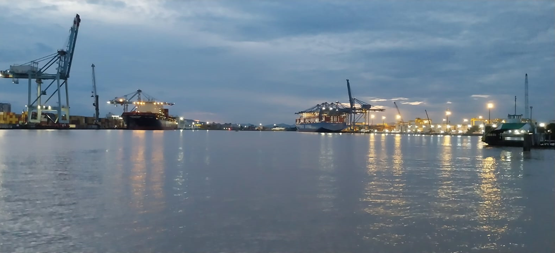
Conditions in the Itajaí-Navegantes access channel, in Santa Catarina, remain a concern as shoaling continues to affect navigation.
Port of Itajaí Superintendent Artur Antunes Pereira said it is difficult to set a timeframe for the full normalization of operations and, above all, for maintaining stable depth conditions in the channel.
According to Pereira, sedimentation has increased as the region goes through a period of adverse hydrological conditions, including successive episodes of heavy rainfall and a sharp increase in the flow of the Itajaí-Açu River. The stronger flow, in turn, has carried more sediment into the access channel.
“In recent weeks, there have even been temporary closures of the channel because currents exceeded the safety parameters established for navigation,” he said.
Despite the exceptional hydrological conditions, Pereira said the channel remains navigable and port operations are taking place within the safety parameters established by the Maritime Authority.
Vessels, however, have not been able to operate at full capacity, affecting operations and generating economic losses.
New depth restrictions
The Itajaí Port Captaincy Office, which reports to the Brazilian Navy, last updated the channel’s depth parameters on September 1.
Previous restrictions based on a Draft Adjustment Factor, adopted as a preventive measure, were replaced by new limits defined by the Maritime Authority, Pereira said. The Port Captaincy did not respond to questions from the publication.
The current limits are:
- 12.9 meters in the outer channel;
- 12.5 meters in the inner channel;
- 12.2 meters in Turning Basin 1;
- 12.6 meters in Turning Basin 2.
The parameters were established based on channel conditions and bathymetric surveys conducted during the period.
A dredging campaign using the suction dredger Utrecht was carried out between July 30 and September 10, followed by new bathymetric surveys.
“As soon as the surveys are received by the Port of Itajaí Superintendency, the data will be forwarded to the Maritime Authority for assessment and a possible update of the parameters currently in place,” Pereira said.
According to the superintendent, more than 2 million cubic meters of sediment were removed during the latest dredging campaign.
Shipping industry calls for further action
Fábio Lavor, executive director of the National Center for Transatlantic Navigation, or Centronave, said the dredging work was important but remains insufficient.
“Further measures are needed, including dredging, bathymetry and environmental monitoring, as well as permanent monitoring of channel conditions. We need swift action from the public authorities involved so this issue can be effectively resolved and we can return to operating vessels at full capacity in the Itajaí region,” he said.
Centronave has been warning authorities about the situation since November last year.
“We have been following the depth-related problems in the access channel to Itajaí and Navegantes from the outset and have expressed our concern about any reduction that could affect operations,” Lavor said.
He noted that any reduction in depth directly affects vessel carrying capacity and, as a result, causes losses across the foreign trade chain.
“Further restrictions could compromise operating efficiency and generate impacts for the port and shipping sectors,” Lavor said.
Real-time monitoring
The Port of Itajaí also signed an emergency contract this week, without a bidding process, for the installation, operation and maintenance of a permanent hydrodynamic and meteorological monitoring system for the channel.
The contract with UMI SAN Serviços de Apoio à Navegação e Engenharia is worth R$4.49 million and will run for a maximum, non-renewable period of 180 days.
The system will monitor key navigation safety parameters around the clock and in real time, including currents, tides, waves, winds, visibility and rainfall. The information will support decisions on access conditions and vessel maneuvers within the port complex.
The system will include four physical monitoring stations and two numerical modeling points, covering approximately 9.3 kilometers of the waterway access.
Source: A Tribuna
-
Grains
Jun, 22, 2023
0
Argentina becomes second largest buyer of Brazilian soy in 2023
-
Vessel Calls
Aug, 15, 2021
0
Container vessel calls at Brazilian ports fall 4.55% in July
-
Ports and Terminals
Feb, 16, 2023
0
Brazil’s Paraná state preps port terminal auction
-
Shipping
Apr, 04, 2022
0
Singapore investigates contaminated HSFO cases